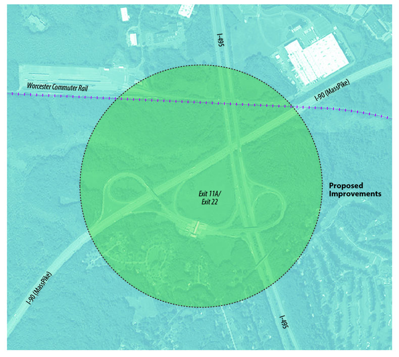
This project proposes to improve the interchange of Interstate 90 and Interstate 495. A number of alternatives are being developed and evaluated in the current feasibility study. Modifications to the existing ramp alignments, widening, and bridge improvements, as well as construction of new ramps and associated bridges, are under consideration. This interchange has been identified both in a joint study by the Boston Region and Central Massachusetts Metropolitan Planning Organizations (MPOs) and by elected officials in central Massachusetts as a critical linkage in need of redesign and reconstruction. The Massachusetts Department of Transportation (MassDOT) performed a planning study in 2012 and 2013 and a feasibility study in 2014. An environmental notification form was filed on March 2, 2015.
In 2015, MassDOT traffic counts found average weekday traffic on Interstate 495 north of Interstate 90 to be approximately 101,100 vehicles, and 99,700 vehicles south of Interstate 90. Ramp volumes ranged from 13,100 to 18,100 vehicles depending on direction. Historically, congestion at this interchange has been associated with the toll plazas. The implementation of the All Electronic Toll System is slated for July 2016; however, the removal of the toll plazas is not expected to eliminate the congestion and safety issues. Several of the ramps currently operate at level of service “D” or worse, and will be significantly improved with the proposed changes. This is a limited-access interchange, so no pedestrian or bicycle use is allowed.
This location has been identified in the MassDOT Highway Safety Improvement Program as a hazardous road location and includes a crash cluster that ranks within the top five percent of the MPO. Sharp curves on both ramps have led to numerous accidents, including rollovers of large trucks. The project will also eliminate conflicts as a result of weaving movements.
The current interchange geometry is substandard, and the geometric modifications will be a substantial improvement. In addition, there will be improvements to the existing bridges, including bridge deck replacement, rehabilitation, and bridge replacement, as well as significant reconstruction.
This project will provide substantial opportunities for economic development in the region. In a planning document sponsored by the Executive Office of Housing and Economic Development, the region surrounding the interchange was identified as a Priority Development Area.
This project is not within an Environmental Justice area.

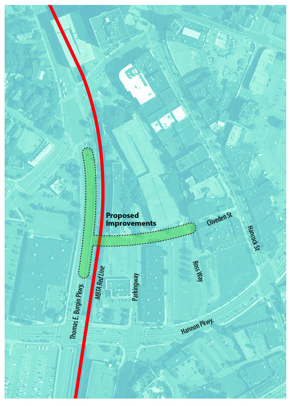
This project will construct a new bridge, referred to as the Burgin Parkway Access Bridge, over the Massachusetts Bay Transportation Authority (MBTA) railroad alignment in order to connect a proposed street on the east side and Burgin Parkway on the west side. The bridge location is approximately midway between Hannon Parkway and Granite Street. The proposed roadway will include two 11-foot-wide travel lanes, one in each direction, with 5-foot-wide shoulders and 5- to 6-foot-wide sidewalks on each side.
Reconstruction of Burgin Parkway is required to accommodate a raised profile to obtain vertical clearance for the bridge. Burgin Parkway reconstruction will include:
No traffic studies have been performed to date; however, building this bridge will provide another means of access to the Quincy Center redevelopment area. The roadway has been designed for 6,000 vehicles per day.
The bridge will be built over the MBTA railroad alignment but it will not provide access to an existing station. The new connection is located between the Quincy Center and Quincy Adams Red Line stations. No information is available regarding potential bus usage on this new roadway connection.
New sidewalks will be constructed on the new roadway and continue on both sides of the bridge on Burgin Parkway. The sidewalk will tie into existing sidewalks on Burgin Parkway to the north and taper down to match the existing cross-section with no sidewalks to the south. An alternative has been included to construct a sidewalk along Burgin Parkway to the south to comply with Massachusetts Department of Transportation's (MassDOT’s) Healthy Transportation Directive. In addition, the new roadway will include 5-foot-wide shoulders that will allow for bicycle travel. Bicycle shoulders will be provided on Burgin Parkway.
There is no recent crash history at the project location. Safety benefits may be realized at other locations adjacent to the project area that have less traffic. The raised median on Burgin Parkway will provide for safer conditions in that area.
This is a new connection to the transportation system.
This project is part of the Quincy Center Redevelopment Project, which involves a multiphase, multiuse rejuvenation of a major portion of Quincy Center. The development includes new office, retail, residential, and parking facilities that will be constructed in phases over several years. The project will provide a new connection to the transportation system and improve traffic flow in the redevelopment area.
This project is not within an Environmental Justice area.
